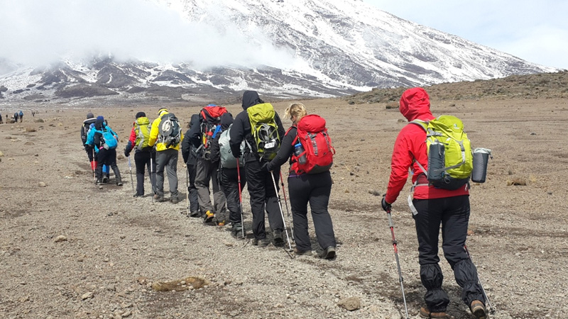
WHY THIS ITINERARY?
A 7 Days Rongai Route ascent that is relatively gradual. The numbers of hikers on this route tends to be less than Machame or Marangu Routes and the chance of seeing wildlife are higher. Comes highly recommended but note that the drive to the starting point takes a long time and the descent is via the Marangu route – in other words, busy.
DESCRIPTION
A 7 Days Rongai Route ascent of Kilimanjaro starting on the Eastern side of the national park. This side of the mountain is relatively dry and has a relatively short forest zone. It skirts the base of Mawenzi and the ascent is via Gilman’s Point to Uhuru Peak. There is an acclimatisation day at Mawenzi Tarn. The descent is via the Marangu Route.
HIGHLIGHTS
Kilimanjaro: views over the Mawenzi and Kibo saddle, close views of Mawenzi, the Kibo Crater and ash pit and glaciers on the roof of Africa.

ITINERARY
IN BRIEF
Hike Distance – 47miles / 76 km
Vertical Gain – 13,885ft / 4232m
Drop – 14,118ft / 4303m
Trekking Time – 43 hours
IN DETAIL
DAY 1 – SIMBA CAMP
START – 6,398FT / 1950M
END – 8,764FT / 2671M
DISTANCE – 3 MILES / 5KM
TIME – 3-5 HRS
CLIMATE ZONE – FORESTS
After breakfast you depart by vehicle to the eastern side of Kilimanjaro National Park. At the gate your crew finalise packing while you enjoy lunch. After finishing with formalities, you start hiking from Nale Moru Gate through farm and pine plantations before arriving at Simba Camp surrounded by afromontane forest.
DAY 2 – KIKELEWA CAVES
START – 8,764FT / 2671M
END – 11,812FT / 3600M
DISTANCE – 10 MILES / 16KM
TIME – 8-10 HRS
CLIMATE ZONE – HEATH
In the morning you ascend to Second Cave (11,319ft, 3,450m) with views of the Eastern Icefields before stopping for lunch. After eating, you leave main trail and head towards Mawenzi before arriving at Kikelewa Caves Campsite in a sheltered valley.
DAY 3 – MAWENZI TARN HUT
START – 11,812FT / 3600M
END – 14,158FT / 4315M
DISTANCE – 2 MILES / 3KM
TIME – 2-3 HRS
CLIMATE ZONE – ALPINE DESERT
Today you hike up to Mawenzi Tarn, located in a cirque beneath the Mawenzi Volcano. In the afternoon you head out for an acclimatisation walk with your guide. Overnight Mawenzi Tarn Camp (full board).
DAY 4 – MAWENZI TARN HUT (ACCLIMATISATION DAY)
START – 14,158FT / 4315M
END – 14,158FT / 4315M
DISTANCE – 2 MILES / 4KM
TIME – 3-4 HRS
CLIMATE ZONE – ALPINE DESERT
Today is an acclimatisation and rest day. Your guide takes you on a gentle exploration hike, which normally lasts for around 3-4 hours before returning back to Mawenzi Tarn Campsite.
DAY 5 – KIBO HUT
START – 14,158FT / 4315M
END – 15,486FT / 4720M
DISTANCE – 5 MILES / 8KM
TIME – 4-6 HRS
CLIMATE ZONE – ALPINE DESERT
Today you cross the saddle between Mawenzi and Kibo in the alpine desert zone. You will arrive at your basecamp, Kibo Hut, in time for lunch. In the afternoon it is time to prepare for the night ascent and then an early dinner before heading to bed for a few hours.
DAY 6 – SUMMIT BID / HOROMBO HUTS
START – 15,486FT / 4720M
END – 12,205FT / 3720M
DISTANCE – 13 MILES / 21KM
TIME – 13-17 HRS
CLIMATE ZONES – ALPINE DESERT / ARCTIC / HEATH
Rising early (normally before midnight) you start out from Kibo Hut towards the peak. At night time the scree sections are normally much firmer and the night time start enables the best chance of a clear summit attempt. It takes around 6 hours to reach Gilman’s Point and then a further 1.5 to 2 hours to reach Uhuru Peak (Alt 19,341ft, 5985m) the top of the highest free standing mountain in the world and the roof of Africa! You then descend the same route before a short stop at Kibo Hut for a refuel and rest. By the evening you descend back down to Horombo Huts for dinner and one last sleep.
DAY 7 – ARUSHA
START – 12,205FT / 3720M
END – 6,164FT / 1879M
DISTANCE – 12 MILES / 19KM
TIME – 5-7 HRS
CLIMATE ZONE – HEATH / AFROMONTANE FOREST
The final descent takes you back through the heath zone and forest to Marangu Gate. After taking the diplomats, lunch and saying farewell to your crew, you are picked up and transferred back to your lodge for a well deserved shower! Later that evening you will be visited by a Golden Peaks Representative to congratulate you, to find out how the trip went and to answer any final questions you may have about your onward journey.
END OF YOUR 7 Days Rongai Route
7 Days Rongai route Includes:
- Park fees, (entry fee camping/hut fees & rescue fees crew fees)
- 18% VAT on tour fees & services
- Three health and fresh meals
- Professional and experienced mountain Guide
- Professional and experienced cooks.
- Transportation to & from the airport
- Transportation to & from the mountain gates
- Enough number of porters for your luggage, food, water, and camping equipment.
- Food, shelters, and fair wages for the porters, cooks, and guides
- Camping gears (sleeping tents, dining tents, tables, chairs, and cooking gear)
- Radio and cell phone communication that help us to stay in contact within and outside the group therefore we can respond almost instantaneously to whatever issue that may arise
- We provide our guides with professional first aids kits and pulse oximeters for daily updates of acclimatization progress
- Assistance with climbing permit procedure
- Tracking of the expedition is available online in our Instagram, WhatsUp, and Facebook accounts
7 Days Rongai route Excludes:
- Personal porters
- All international and domestic flights
- Tourist Visas
- Medical and Travel insurance
- Tips to mountain crew
- Mountain trekking gears e.g. walking poles (available for hire upon request)
- Sleeping Bag (available for hire upon request)
- A portable flush toilet with a toilet tent is extra (US$200 per toilet + toilet tent)
- Others; Extra expenses as food or drinks separate from those described in the itinerary, satellite phone calls, transference fees, and other services not specified as included.
- Any other alterations to our itineraries
- Emergency Oxygen

